
Banda Aceh Off The Beaten Path
Not Just Any Hotel – Only the Best Banda Aceh Off The Beaten Path, Selected for You!
Jun 17, 2026 - Jun 18, 2026
2 adults, 1 room
Find

Good
(50)
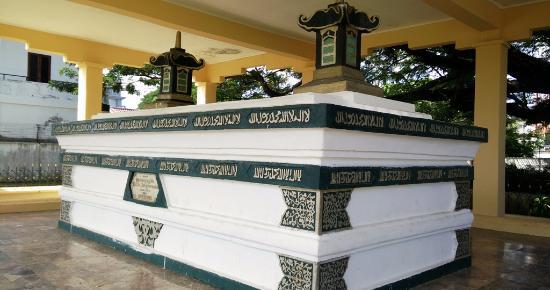
Makam Sultan Iskandar Muda
07:00 AM-6:00 PM
Cemetery
Jln. Baperis no. 1 Komplek Baperis
View map
Makam Sultan Iskandar Muda is a historical cemetery located in Banda Aceh. It is the final resting place of Sultan Iskandar Muda, an important ruler known for his impact on Aceh's history and trade.
Duration: approx. 1 hour
Free

Good
(2)
Haloban Island
8:00 AM-6:00 PM
Island
Tuangku
View map
Haloban Island is a small, serene island near Banda Aceh. It offers beautiful beaches, clear waters, and lush greenery, making it a perfect spot for relaxation and nature walks.
Duration: approx. 2-3 hours
Free

Taman Makam Pahlawan
8:00 AM-5:00 PM
Cemetery
Kp. Ateuk
View map
Taman Makam Pahlawan is a memorial park dedicated to the heroes of Aceh. It features beautiful gardens and marked graves, honoring those who fought for the country's freedom.
Duration: approx. 1-2 hours
Free