
Munising Off The Beaten Path
Not Just Any Hotel – Only the Best Munising Off The Beaten Path, Selected for You!
Jun 17, 2026 - Jun 18, 2026
2 adults, 1 room
Find


Good
(795)
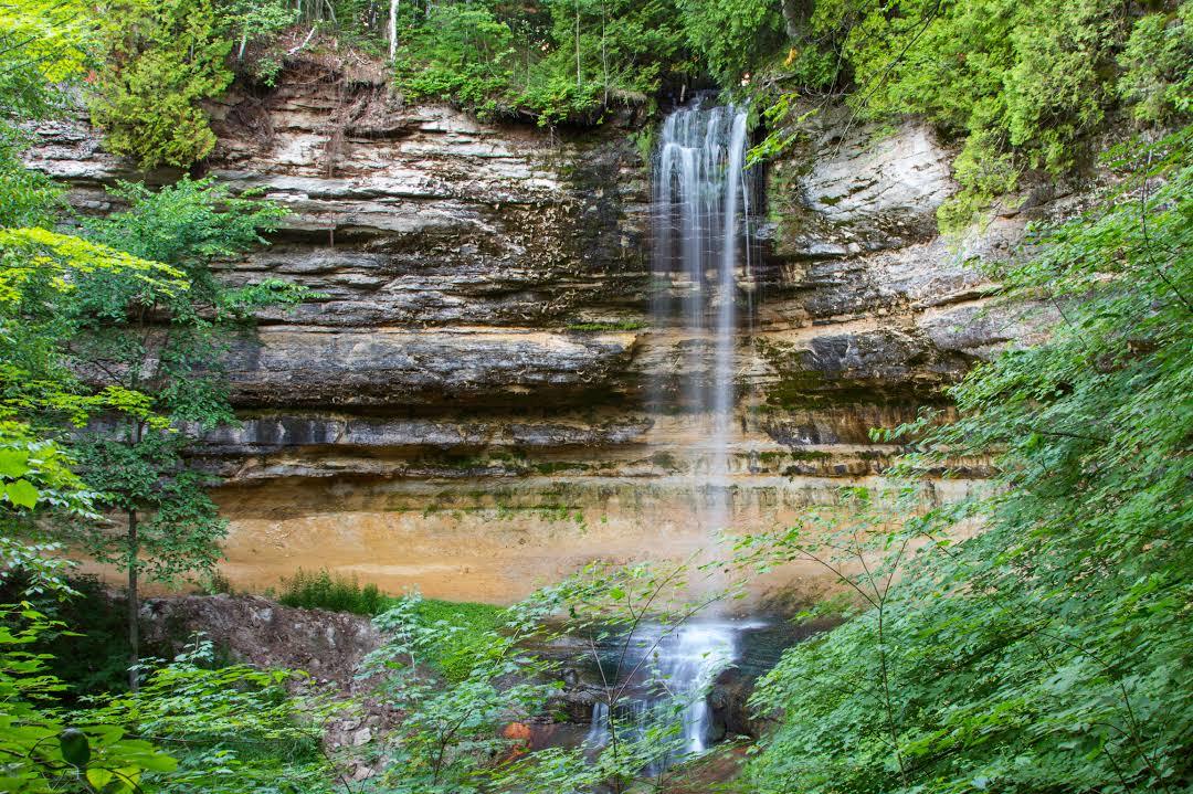
Munising Falls
Open all day
Waterfall
Sand Point Rd
View map
Munising Falls in Michigan features a 50-foot waterfall with a forested trail and a viewing platform, providing a scenic experience for nature enthusiasts.
Duration: 1 to 2 hours.
Free. No entrance fee is required to access the falls.


Good
(72)
Spray Falls
Sunrise-Sunset
Waterfall
Pictured Rocks National Lakeshore
View map
Spray Falls in Munising, Michigan is a scenic waterfall cascading 70 feet into Lake Superior, offering spectacular views and outdoor activities.
Duration: 1-2 hours.
Free access to Spray Falls. Some guided tours or boat rides may charge fees.

Tannery Falls
Always open
Waterfall
Munising
View map
Tannery Falls in Munising, Michigan is a beautiful natural waterfall cascading amidst lush forests. It offers hiking trails and scenic views.
Duration: 1-2 hours.
Free. No admission fee required.

Bay Furnace Campground
Open 24 hours
Camping
Bay Furnace Rd
View map
Bay Furnace Campground in Munising offers a natural retreat for camping enthusiasts, featuring wooded sites, access to Lake Superior, and outdoor activities.
Duration: Minimum of 2 days recommended.
$20 per night per site. Some additional fees may apply for extra vehicles.


Good
(143)
Horseshoe Falls
8:00 AM-8:00 PM
Waterfall
602 Bell Ave
View map
Horseshoe Falls is a stunning waterfall located in Munising. It features a beautiful cascade and is surrounded by lush greenery, making it a popular spot for visitors.
Duration: approx. 1 hour
Free